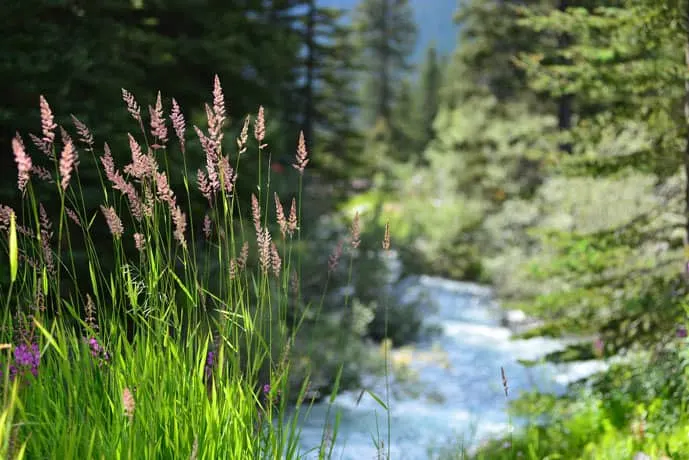
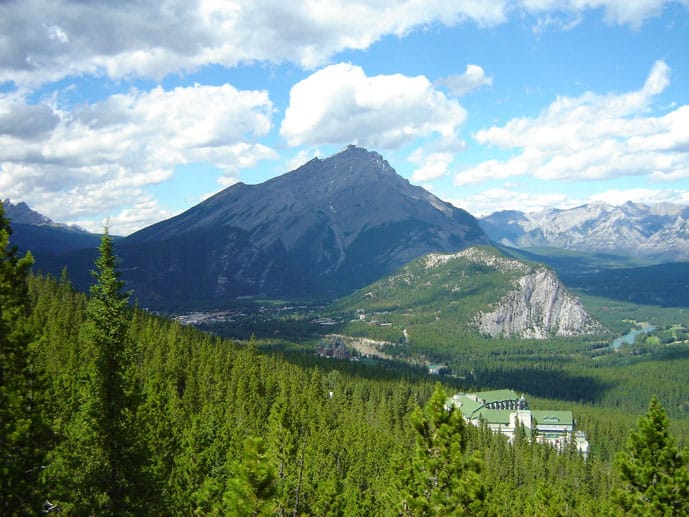
Guaranteed adventures and vibrant views, Banff is a gem in the Canadian Rockies. A perfect place for those looking to spend some time in nature and outdoors.
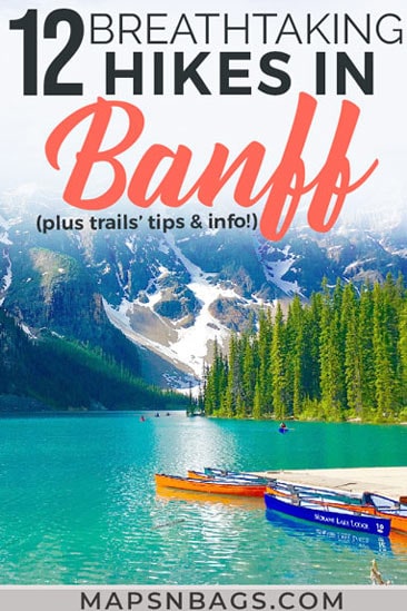
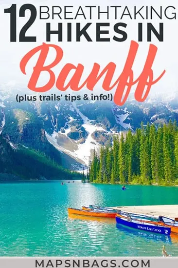
Banff is huge and as you might have imagined, there are countless options of trails here, but we have listed below the best hikes in Banff (with all the information you need), just so you can get the most out of your trip to Alberta.
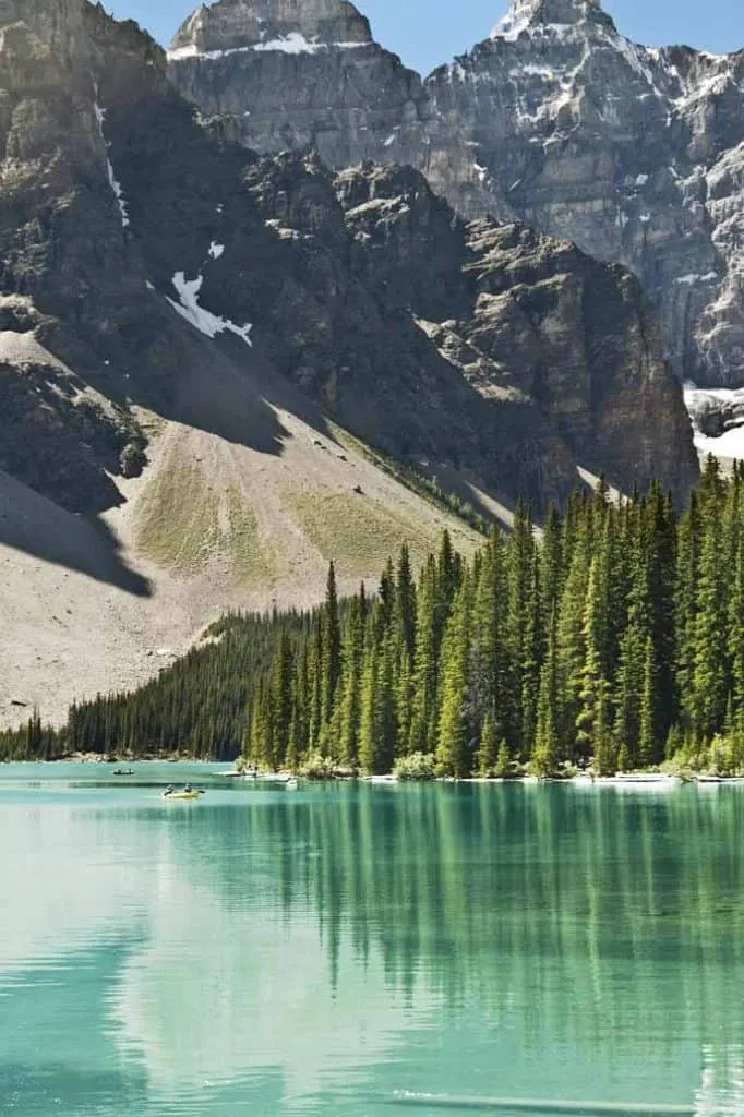
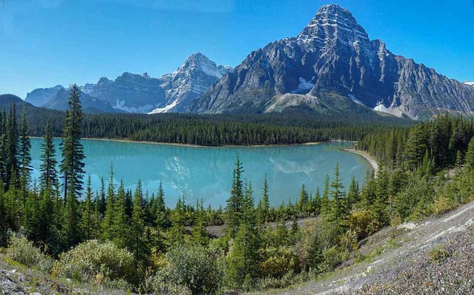
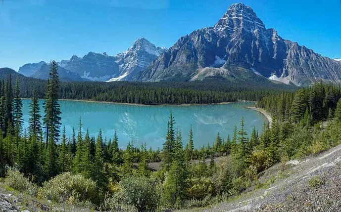
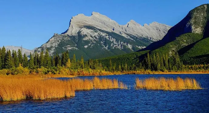
The park is known for some of the most beautiful and vividly colored lakes in North America, which is another reason to add hiking to your Banff itinerary – so that you can discover these hidden spots!
We have written this post for you with the best day hikes in Banff, including the best time to visit, trail maps, how to get around and what to bring to Banff National Park, to name a few.
Not an experienced hiker? That’s not a problem. We have listed below not only some moderate and very challenging difficult trails but also some of the best easy Banff hikes.
In other words, there are trails for all levels. So no excuses here, go discover those epic hikes around Banff, one of the most beautiful places in Canada!
In today’s post we’ll talk about:
- Important things to know
- General tips for hiking in Banff
- How to get to Banff
- Where to stay in Banff
- How to get around Banff
- Parking in Banff Town
- Admission to the National Park
- What to pack for Banff
- Best time to visit Banff
- Best easy hikes in Banff National Park
- Best moderate hikes in Banff National Park
- Best difficult hikes in Banff National Park
- Banff National Park Map
Hiking in Banff National Park
Banff is a small town in Alberta, Western Canada, where millions of tourists come to hike in the Canadian Rockies every year and see the famous
Banff National Park.
The greenery, the rocky mountain range, and even the waterfalls near Banff make for some epic hiking trails that draw nature lovers and hikers. The best part is that the trails around Banff vary in the level of difficulty.
So, people with any ability, from beginners to experts, can enjoy the trails in this region.

Best Hikes Banff National Park – Practical Tips
Important things to know before hiking in the Banff National Park
- Always check in advance the Banff Trail Condition Report;
- There are seasonal closures of specific trails to avoid avalanches and protect the animals (and you). Check out here if the trail you’re going is affected. Some trails might require a group of 4 adults;
- Be a responsible tourist and pack out all your trash;
- Leave what you find. Don’t take souvenirs with you such as fossils, wildflowers, etc;
- Respect wildlife: do not feed the animals and remember to give them the space they need to be and feel safe;
- After a day of hiking in Banff, relax in one of the hot springs throughout the park;
- This is important to remember in the Instagram era: do not risk your life to take the perfect selfie or photos. There are plenty of places in the mountains where it can be dangerous to come too close to the edge or to the animals. It’s not worth it!
General tips for hiking in the Banff National Park
- Be sure to follow signs and obey warnings. If the trail you were planning to hike is closed, respect it;
- Don’t rock hop if it’s raining as it can be dangerous;
- Mind every step in difficult terrains, such as scree and boulder fields;
- Use hiking poles for support, especially on scree;
- In high altitudes, the lower air pressure makes difficult for oxygen to enter our vascular system. So, take it easy and begin slowly;
- If you’re climbing and a loose rock falls down, warn people behind you by screaming “rock!”;
- Be sure to read the best practices to avoid an encounter with a bear and always carry a bear spray with you;
- Be polite and kind to people you see on the trails (and everywhere :));
- On difficult trails, keep the teamwork mentality. Ask other people if they need more water, snacks or a little encouragement;
- Always bring more water, food, and clothes than you think you’ll need;
- I can’t stress this enough, be sure to wear good hiking shoes;
- Dress in layers. The temperature fluctuates and it can rain at any moment;
How to Get To Banff National Park
Assuming you’re arriving at Calgary, the closest international airport, the best way to get to Banff National Park is by car – by far. This airport is the nearest one to the park, by the way.
So, rent a car and take the Trans-Canada Road to the town of Banff. The whole drive is around 120 km (75 mi) far.
Click here to check rental car prices.
Where to Stay in the Banff National Park
There are plenty of accommodation options for different budgets in Banff. Also, note that the first week of July and August are holidays in Alberta, so it’s smart to book in advance.
If you’re on a tight budget, you might consider camping in Banff. This is one of the cheapest accommodation types, together with some hostels, and the best way to have a complete outdoor experience. Check out the Parks Canada website to find the best camping in Banff National Park.
If you prefer to stay in a hostel, take a look at the Banff International Hostel. Rooms are comfortable, have good WiFi, and USB plugs.
The hostel itself has a great atmosphere, so you can easily make friends there and maybe even go on a hike together.
The Brewster’s Mountain Lodge is one of the best mid-range accommodations for those who want more comfort than camping or more privacy than a hostel, but can’t afford (or just don’t want to pay) so much for a fancy room.
The location couldn’t be better, near everything in the town center. The decoration is homey and cozy, a typical mountain decoration. All rooms include free WiFi, tv, and coffee maker.
An extravagant and luxury option is the Moose Hotel and Suites, which has an indoor swimming pool and 2 rooftop hot pools. What about the view? Absolutely amazing view of the Canadian Rockies. All rooms include air conditioning, tv, and coffee maker.
Read next: Unique travel destinations around the world
How to Get Around Banff
Renting a car is by far your best option when it comes to getting between trails and the town of Banff, and the airport, as we mentioned above.
There are a few shuttle services for crowded areas in the park, such as Lake Louise and Lake Moraine; however, having a car will make your life much easier.
Besides, Banff is such a beautiful place that it makes up for the perfect Canada road trip.

Parking in Banff Town and in the Banff National Park
The Town of Banff has on-street parking and off-street lots with one-hour to 12-hour limits. See map.
Parking in the Banff National Park, which means, parking for the trails outside the town, can be tricky and annoying because of the crowds. Namely near Lake Louise and Lake Moraine. Click here for real-time parking information.
In this case, you can either be an early bird and be there at 6-7 am or drive to Lake Louise Overflow Parking Lot, near the road, to take the shuttle bus to the entrance of Lake Louise or Lake Moraine.
The shuttle takes around 10 minutes to arrive at both of the lakes. Mind that there are free shuttles and private ones.
Alternatively, you can take a shuttle bus directly from Banff Train Station to Lake Louise and save the hassle of trying to park. The shuttle takes 75 minutes to arrive there and it costs $10 for a round trip.
Pssst: The shuttle to Moraine Lake only runs from mid-September to mid-October for the larch season.
Read next: Romantic Things to Do in Vancouver
Admission to the Banff National Park
To visit the Banff National Park you have to purchase a pass which can either be the Daily Pass or the Discovery Pass, it will depend on the length of your stay.
While buying the tickets, the website indicates which option is more economical for you.
What to Pack for Hiking in Banff National Park
You can also find the PDF of the packing list below here! Also, be sure to read this post with tips on how to pack light.
Hiking clothes
- Quick-drying pants
- Breathable t-shirts/ tops
- Long-sleeve shirts to protect against mosquitoes and the sun – men’s version
- Down jacket for insulation (it’s always chilly in high altitudes) – men’s version
- Rain jacket or poncho
- Sturdy hiking boots – men’s version
- Wool socks
- Hat/ Neck Warmer
- Sport Bras
- Underwear
- If you’re going to hike in colder months: fleece pants, beanie, gloves
Accessories
- Sunglasses
- Hiking backpack or daypack with rain cover
- GoPro/ camera
- Travel wallet
- External charger or solar charger
- Adaptor and converter
Toiletries
- Repellent
- Sunscreen
- Lip balm
- Hand sanitizer
- Menstrual cup
- Package of tissues
Hiking Gears
- Travel insurance
- Bear spray
- Hiking poles
- Ice climbing pick (for the Mount Rundle Summit Trail)
- Map and compass/ GPS
- Dry bag
- Hammock
- Cleats/ Microspikes (winter)
- Reusable water bottle
- Water Filter
- Camelback hydration system
- First aid kit
- Safety items: Flashlight, whistle, lighter/ matches, emergency shelter
Food
- Sandwich for lunch
- Trail snacks, such as superfruits, nuts, energy bars, and chocolate, if it’s not too warm
- Around 2L water per person (it varies per season, trail distance and person, of course)
Banff National Park Best Time to Visit
Good news! The park can be seen all year-round. There are lots of things to do in Banff, so the best time of the year to visit the park varies according to your plans.
For skiers, the best time to visit the park is from December through March, while for hikes, it’s from mid-June through mid-October.
Transitional months (aka mid-April through mid-June and mid-October through November) are the low season and this also reflects in tickets and accommodation prices. By the way, the weather can be unpredictable around this period (more than it already is).
June through August are the most crowded months, as you probably have guessed. However, June is the wettest month in the Canadian Rockies and the chances are high that the lakes are still frozen.
Wait till mid-late-Summer to see their bright blue color.
But when is the best time to visit Banff without crowds, but still fairly good weather? I would say in September, after Labor Day (first Monday of September).

Top 12 Best Hikes in Banff National Park
Best Easy Hikes in Banff
1. Fenland Trail
Let me start off with a very easy hike – the Fenland Trail. You will find this trail on the Mt. Norquay road, just as you enter Banff from the Trans-Canada highway.
This 1.8 km loop features a well-maintained dirt path that winds through a forested region with a translucent creek running along most part of it.
The Fenland trail is really a piece of cake. Perfect for those who want a relaxing hike in the woods and want to spot some wildlife. The thick forest cover and the creek attract a lot of wildlife to this area.
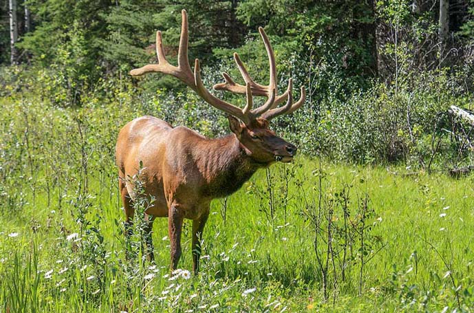
You will probably spot many birds and an elk or two during the walk. Also, be sure to carry a mosquito/ bug spray with DEET. Mosquitoes are ruthless during these walks, especially during the summer.
- Complete Distance: 1.8 km (1.2 miles)
- Type of trail: Loop
- Elevation Gain: 55 m (180 ft)
- Altitude: 1,392 m (0.86 mile)
- Time required: Around 20-30 minutes
- Best time to go: June through August
- Directions: From downtown in Banff take Mount Norquay Rd north towards Hwy 1. The trailhead for the Fenland Trail is at a parking area to the left on Mt. Norquay Rd just prior to Hwy 1.

2. Vermilion Lakes Trail
Another trail that is close to the town of Banff is the Vermillion Lakes trail. This trail is an easy hike around the marshlands and lakes of the region. It can be combined with the Fenland trail as they are very close by.
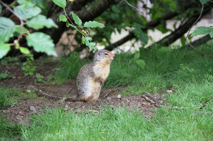
Bird watchers and wildlife enthusiasts are bound to love this trail as there is ample opportunity for you to catch a glimpse of local animals and birds here, such as beavers and woodpeckers.
Even grizzly bears are known to frequent the Vermillion lakes to drink water and to catch some fish.
You will also enjoy the dramatic reflection of Mount Rundle on the still water of vermillion lakes. In fact, this is one of the most photographed sceneries in Banff, so don’t forget your camera.
Maybe you can even photograph some crazy phenomenon in the frozen lakes like this photographer captured methane bubbles.
In addition, this makes for one of the best winter hikes as the elevation gain is minimal and also hot springs, so maybe you’ll find a pocket of water to photograph a striking mountain reflection.
Pro tip: Vermilion Lakes Trail also makes for one of the best (and easiest) bike trails in Banff with a serene view.
- Complete Distance: 6 km (3.7 miles)
- Type of trail: Out and back
- Elevation Gain: 281 m (922 ft)
- Altitude: 1,417 m (0.88 mile)
- Time required: Around 1:20 – 2:30 hours
- Best time to go: June through August
- Directions: You basically go a bit further than the Fenland Trail. Again, from downtown in Banff take Mount Norquay Rd north towards Hwy 1. Then continue past the Fenland Trail parking area a short distance and turn left on Vermillion Lakes Dr. there is a parking area here.

3. Tunnel Mountain Trail – One of the best hikes in Banff Canada
The Tunnel mountain is one of the best hiking trails in Banff National Park according to many visitors to the area. This trail is considered a bit-challenging-easy-trail because it’s constantly uphill.
At the top, you can see gorgeous views of the town of Banff and the golf course beside the Fairmont Banff Springs hotel below.
Since this trail is fairly easy to climb and so close to the town, it’s usually very crowded. Locals also use this trail often for dog walking and fitness. So, if you want to skip the crowds, visit it very early in the morning or late in the evening, but make sure it’ll be light to come back.
- Complete Distance: 3.9 km (2.4 miles)
- Type of trail: Out and back
- Elevation Gain: 261 m (856 ft)
- Altitude: 1,678 m (1.04 miles)
- Time required: Around 1 – 2 hours
- Best time to go: All year long
- Directions: Park on Tunnel Mountain Drive or go on foot from Banff Avenue (1.1km/ 0.68mi).

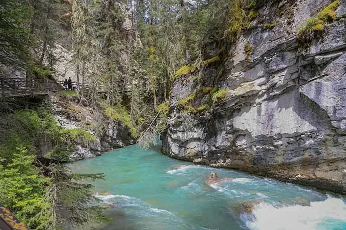
4. Johnston Canyon Trail
This man-made path is attached to the edge of the Johnston Canyon and has some rails for support. As you walk along the path, you can look at the Johnston Creek below.
This easy trail is more a path than a trail. While this hike is beautiful, it’s not as peaceful as being lost in the wilderness. The Johnston Canyon Trail is very popular, so during peak season avoid this route between 8:30 am and 5 pm.
The narrow path means that you will have to squeeze your way through, when there is two-way traffic, and keep moving so you won’t block the path for others. This kind of takes away the joy of hiking a bit.
However, the waterfalls in this area are worth all the annoyances that you face along the way to get there (tip: get there early!).
But note that the Upper Falls are much prettier than the Lower ones, so don’t stop when you see the first waterfall. Continue the path and you’ll be rewarded with an amazing view.
- Complete Distance: 5 km (3.1 miles)
- Type of trail: Out and back
- Elevation Gain: 236 m (774 ft)
- Altitude: 1,586 m (0.99 mile)
- Time required: Around 1 – 2:30 hours
- Best time to go: May through early October
- Directions: From Banff, head west on the Trans-Canada Highway towards Lake Louise. You can take the scenic route and take the Bow Valley Parkway exit (#1A) and drive along this all the way to Johnston’s Canyon (18.1km/ 11.25mi) or else take the Trans-Canada all the way to Castle Mountain Junction and driving back 5.5km/ 3.42mi.

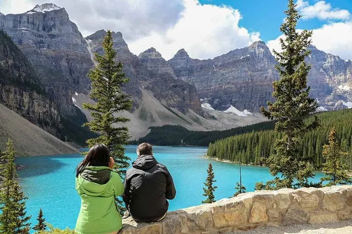
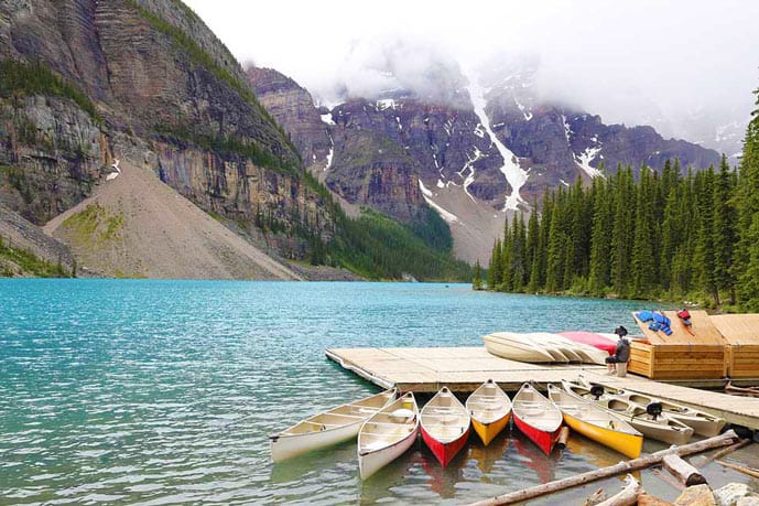
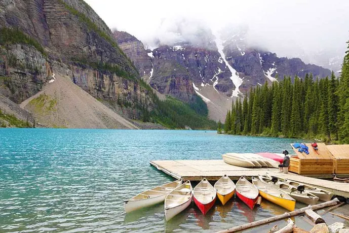
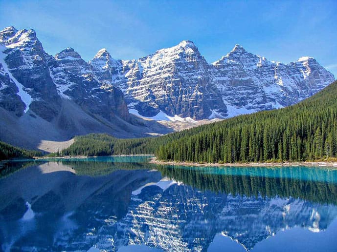
Bonus Easy Hiking Trails in Banff: Moraine Lake Shoreline Trail
Well, you’re not an adventure junk, that’s why I’ll give you a bonus easy hike in Banff.
The Moraine Lake Shoreline Trail paved pathway is jam-packed with tourists, as the other trails around the Lake Louise Area (we’ve described the main ones below).
So consider arriving early if don’t want to compete for a parking spot or waiting for other people before you to walk on the lakeshore trail.
However, when you actually see the Moraine Lake glowing, vibrant and blue, you will understand the reason why this one of the best hikes in the Canadian Rockies.
Also, this is a very easy hike, seriously, effortless! So you if you’re planning a hiking vacation leave this one to the last day to take it easy.
Important Things to Note about the Moraine Lake Area: The road to Moraine Lake is closed from mid-October to mid-May due to high avalanche risk.
Pro tip 1: Reserve some time to rent a canoe.
Pro tip 2: Climb (very early in the morning) to the top of the Rockpile at the beginning of the trail to take nice photos of the lake, preferably with a tripod.
- Complete Distance: 2.9 km (1.8 miles)
- Type of trail: Out and back
- Elevation Gain: 162 m (531 ft)
- Altitude: 1,949 m (1.21 mile)
- Time required: Around 30min – 1:30 hours
- Best time to go: May through early October
- Directions: From Banff, head west on the Trans-Canada Highway towards Lake Louise. Take the exit to Lake Louise Drive and turn left on the Moraine Lake Road. Remember to be there around 6-7 am to find a parking spot. For parking information read the paragraph about practical tips after all the trails.
Best Moderate Hikes in Banff National Park
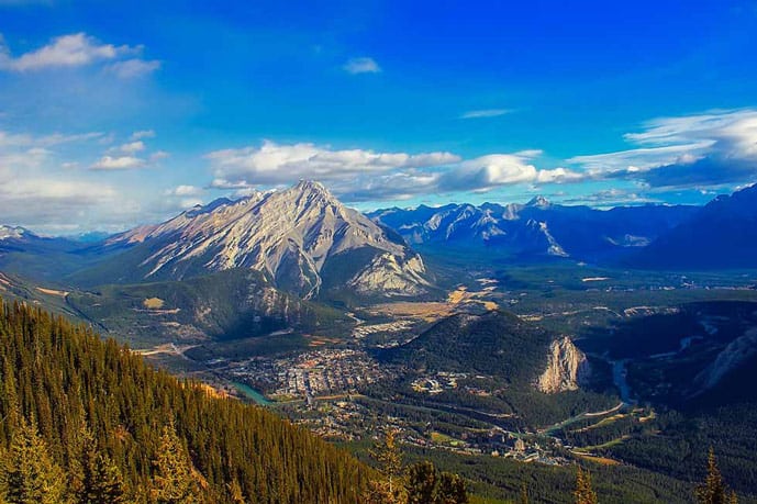
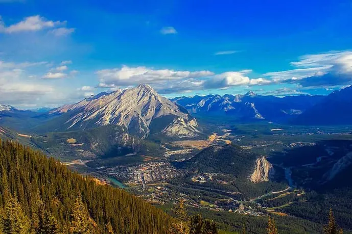
5. Sulphur Mountain Trail – Banff Gondola Hike
The hike up to Sulphur mountain is one of the most rewarding trails you’ll find while hiking in Banff. It’s classified as moderate, but I would say it’s moderate-difficult.
This trail has some narrow paths with steep drops that can get slippery especially during spring or fall. So, good hiking shoes for this trail are a must.
Although this alpine pathway has mostly switchbacks, it is fairly easy to walk on. The Sulphur Mountain trail also has lots of trees, but there are still breathtaking views you can spot here and there on the openings.
When you reach the top, you will see peaceful views of the rocky mountain range all around you. The Bow Valley, with the Bow river snaking through it, and the Town of Banff are both clearly visible below.
This trail is also known as ‘Banff Gondola hike’ because of the famous gondola service to the top of the mountain, which is often crowded with tourists.
While the crowd is a negative aspect of the gondola service, the positive is that you can use the service on the way back if you are tired or just to rest your legs. The ride takes around 8 minutes.
If your legs are sore from the hike, stop by the hot spring at the trailhead to relax.
Pro tip: Anytime during winter, hikers can take the Sulphur Mountain Gondola ride down for free, but only down.
- Complete Distance: 10.1 km (6.3 miles)
- Type of trail: Out and back
- Elevation Gain: 744 m (2.441 ft)
- Altitude: 2,273 m (1.41 miles)
- Time required: Around 2:30 – 3:30 hours
- Best time to go: June through August
- Directions: From Banff, head south on the Banff Avenue towards Cascade gardens. Then turn left on Spray Avenue and take the first right to Mountain Avenue. The trailhead is at the end of this avenue (3,4km/ 2.11mi).
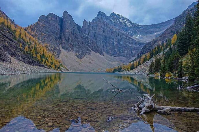

6. Lake Agnes Tea House Trail – One of the best hikes in Canadian Rockies
Lake Agnes has clear, blue water (sometimes Emerald green), a waterfall, and impressive peaks. As you can see the hike to Lake Agnes is among what we call “top Banff hikes.”
In fact, this trail is among the top 10 hikes in Canada. However, so much beauty comes with a price.
It’s also the most famous trail in the Lake Louise area and probably the most famous one in the whole National Park.
Well, as we said, this trail is very famous and popular for a reason, so the views and landscapes you’ll see are certain to be beautiful and have that peaceful look only nature has. So yeah, expect to see many people along the way!
To avoid crowds and find a parking space, as usual, arrive early in the morning (around 6-7 am).
The trail itself doesn’t have many views, as you walk in the forest, but the Mirror Lake and Agnes Lake are totally worth it. The Lake Agnes Tea House, which is the oldest one in Canada, does have great tea and cookies, but there’s a big chance it’s crowded.
So take your sandwich and go picnic somewhere around the lake.
Pro tip: The Tea House only opens mid-May to Mid-October and they don’t accept cards.
Pro tip 2: There are a few other possibilities of hikes in the Lake Louise/ Agnes area. You can either head to Little Beehive Trail from Mirror Lake and on your way back head to Agnes Lake (and maybe hike further Big Beehive Trail=jaw-dropping views from both lakes).
On your way down, you can come back to the trailhead by hiking the Highline Trail towards the Mirror Lake, and then you just have to walk back the way you came in the beginning.
Quite a hike, but totally worth the views. Note that if you follow this great-views-guaranteed-route, you’ll almost double the distance I mention in the stats below.
- Complete Distance: 7.6 km (4.7 miles)
- Type of trail: Out and back
- Elevation Gain: 433 m (1.420 ft)
- Altitude: 2,133 m (1.33 miles)
- Time required: Around 2:30 – 3:30 hours
- Best time to go: June through August
- Directions: From Banff, head west on the Trans-Canada Highway towards Lake Louise. Take the exit to Lake Louise Drive and ride until the Parking lot with the same name. Remember to be there around 6-7am to find a parking spot. For parking, information read the paragraph about practical tips after all the trails.
Read next: USA bucket list

7. Plain of Six Glaciers Trail
Gigantic mountains serenely guarding a glossy blue lake. This view awaits you on the Plain of Six Glaciers Trail. The lake I mentioned is the legendary Lake Louise and trust me when I say that hiking along Lake Louise for about 2 km (0.8mi) will blow your mind.
A pretty rigorous trail with a surprising amount of switchbacks and not much sun coverage, so be prepared! After the lake, you go uphill and it doesn’t stop until the summit.
Again, this trail is also busy as most trails around the Lake Louise area, but it gets better after the lake itself because many people don’t want to go uphill.
Stop by the tea lake on the way up, refill your energy and continue for around 1 km until the end. The mountains, the lake, the glaciers, wow! The views are completely astonishing!
- Complete Distance: 13.8 km (8.57 miles)
- Type of trail: Out and back
- Elevation Gain: 587 m (1.925 ft)
- Altitude: 2,201 m (1.37 miles)
- Time required: Around 3:30 – 5 hours
- Best time to go: June through August
- Directions: It starts at the same place as Agnes Lake Trail, but if you didn’t read it, here it goes: From Banff, head west on the Trans-Canada Highway towards Lake Louise. Take the exit to Lake Louise Drive and ride until the Parking lot with the same name. Remember to be there around 6-7 am to find a parking spot. For parking, information read the paragraph about practical tips after all the trails.

8. C Level Cirque Trail
This is a more challenging hike regarding conditioning. Don’t worry, the C Level Cirque Trail is not a challenging hike, but it’s quite steep, especially at the beginning of the trail, and it gets steeper in the second half, so make sure to wear good shoes.
After around 1.3 km (222 mi) in the trail, when you pass the abandoned house, turn right to have a sneak peek of the glowing blue water of the Lake Minnewanka.
If you’re able to reach the top, you’ll have a jaw-dropping view of the Two Jake Lake and Lake Minnewanka. Hopefully, it won’t be cloudy; then its color will pop-up and give you your next laptop wallpaper. 😉
Pro tip: Make sure to stay on the trail. There’s an old mining area and it can be dangerous.
- Complete Distance: 9.2 km (5.72 miles)
- Type of trail: Out and back
- Elevation Gain: 755 m (2.477 ft)
- Altitude: 2,183 m (1.36 miles)
- Time required: Around 3:30 – 5 hours
- Best time to go: June through August
- Directions: From the Trans-Canada Highway at the Banff East exit interchange, follow the Lake Minnewanka Road 3.5 km (2 mi) to the Upper Bankhead Picnic Area. The trail begins at the far (west) end of the picnic area parking lot.

Best Difficult Hikes in Banff
9. Cory Pass and Edith Pass Trail
An intense uphill with rewarding views at the top, Cory Pass is one of the best day hikes in the Canadian Rockies for experienced hikers.
The Cory Pass Trail is a challenging hike in Banff with scree, boulder fields, and an exposed and slippery slope.
Here you hike through an arid pass at times, other times at a forest section, others you have drops on both sides, and so on. In a nutshell? Expect some enjoyable diversity in landscapes which also needs extra attention to each step.
The elevation gain is pretty intense in the beginning, but once you reach the pass, you’ll realize it was worth it.
At the pass, you can follow a trail up to Mount Edith, which requires some scrambling.
Also, the way back isn’t so steep. Overall a physically challenging and sometimes hard to follow but very rewarding hike!
Pro tip: We suggest you take the clockwise direction. So at the fork, head left to start climbing the Cory Pass and come down on the Edith Pass. It will be easier, albeit there is nothing easy about this trail.
- Complete Distance: 13 km (8.08 miles)
- Type of trail: Loop
- Elevation Gain: 1,168 m (3.832 ft)
- Altitude: 2,365 m (1.47 miles)
- Time required: Around 5 – 7:30 hours
- Best time to go: May through September
- Directions: From Banff, head west on the Trans-Canada Highway towards Lake Louise and take the Bow Valley Parkway (#1A) exit. After 400m you will see a turnoff for Fireside. Take this, and follow the road to the Fireside parking lot.
Read next: Best backpacks for your adventure

10. Devils Thumb via Lake Agnes
Like the Cory Pass, the Devil’s Thumb has different sections too: Scree, boulders, soft sand. So again, watch your steps and bring hiking poles to help along the way.
This trail is a bit challenging, especially at the end when it gets really steep but totally doable.
The top will give you one of the most rewarding views: Lake Agnes and Lake Louise divided by the Big Beehive. On the left, you’ll spot the Little Beehive. If you’re like me and hike with a good camera, this place is literally a wonderland, so take your photo gears with you.
The trail begins at the Lake Louise and you’ll basically follow the hike to the Lake Agnes. From there, head to the Big Beehive Trail until you reach an intersection. To the left you’ll find Big Beehive, to the right is Devils Thumb.
Pro tip: When hiking the steep scramble to the top, don’t go straight up, stay left for a less steep path.
- Complete Distance: 11.9 km (7.39 miles)
- Type of trail: Out and back
- Elevation Gain: 883 m (2.897 ft)
- Altitude: 2,449 m (1.52 miles)
- Time required: Around 6 – 7:30 hours
- Best time to go: April through October
- Directions: It starts at the same place as Agnes Lake Trail, but if you didn’t read it, here it goes: From Banff, head west on the Trans-Canada Highway towards Lake Louise. Take the exit to Lake Louise Drive and ride until the Parking lot with the same name. Remember to be there around 6-7 am to find a parking spot. For parking, information read the paragraph about practical tips after all the trails.
11. Sentinel Pass via Larch Valley Trail (Golden Larch Hike)
The Sentinel Pass via Larch Valley is quite a difficult trail because of its switchbacks at the beginning and at the end, but totally worth it – the mountain backdrops will make you forget the path until the top of the pass.
It starts at Lake Moraine, so expect to see a lot of people. The early-bird rule is also valid here: the earlier you get there, the better.
There are some larch hikes in Banff, and this is one of them. If you want to see the golden larch contrasting with the cold mountains, plan your hike around the second half of September.
Important Things to Note about the Moraine Lake Area
The road to Moraine Lake is closed from mid-October to mid-May due to high avalanche risk.
Also, there is a seasonal trail restriction (mid-July through mid-October) to minimize disturbance to bears. If you’re there around this time (Golden larch season), you’re required to be in a group of at least 4 people before starting the hike.
If you’re headed this trail during the seasonal restriction, be sure to read the best practices to avoid an encounter with a bear and what to do in case you see one.
Pro tip: Purchase a bear spray and keep it in an easy place to get in case you need it.
- Complete Distance: 10.9 km (6.8 miles)
- Type of trail: Out and back
- Elevation Gain: 792 m (2.598 ft)
- Altitude: 2,600 m (1.62 miles)
- Time required: Around 4:30 – 5:30 hours
- Best time to go: June through August
- Directions: From Banff, head west on the Trans-Canada Highway towards Lake Louise. Take the exit to Lake Louise Drive and turn left on the Moraine Lake Road. Remember to be there around 6-7 am to find a parking spot. For parking, information read the paragraph about practical tips after all the trails.

12. Mount Rundle Summit Trail
If you’re an experienced hiker looking for an exciting challenge, try the Mount Rundle Summit Trail. It starts as a calm walk in the woods, then you get to a tree line where the roots give a nice help uphill.
After this tree line is when the fun begins: you hike scramble uphill on the scree and loose rocks at a near 45 degrees, this section is called Dragon’s back. Don’t give up, continue the trail until the summit and you’ll breathe relieved that you didn’t turn around.
On the way down, pay extra attention to this last part as you have to descend the scree (read my quick explanation below).
Overall one of the best hikes in Banff with a mental and physical challenge.
- Complete Distance: 13.4 km (8.33 miles)
- Type of trail: Out and back
- Elevation Gain: 1,620 m (5.314 ft)
- Altitude: 2,943 m (1.83 miles)
- Time required: Around 6 – 9 hours
- Best time to go: June through August
- Directions: From Banff, head south on the Banff Avenue towards Cascade gardens. Then turn left onto Spray Avenue and left again onto Rundle Avenue. Turn right onto Bow River Avenue. Drive straight ahead until you see the Bow River Falls parking lot. Park there and walk the rest of the way (around 200m) towards Golf Course Road. The trailhead is right after the bridge.
How to descend a steep scree?
Some of the trails mentioned above require you to descend a steep scree and if you’re not an experienced hiker, it can be quite tricky.
So, stand on your side and use a trekking pole as a third leg on the side of the mountain. This way you can lean a bit towards the pole and walk/ slide sidewards down and if you fall, it will be on your derriere and not on your face. By the way, your feet should not point downhill.
Best Hikes in Banff Trail Map
Click here to access the interactive Banff National Park Map.
Wrapping up on best hikes in Banff
There are lots of hiking trails in the Canadian Rockies so it can be overwhelming to research them, to know which have the best view and match your hiking skills.
That’s why we hope you’ve found this post about the best hikes in Banff useful, and you chose a hike that suits you best.
You may also like:
Have you already been to Banff? Please comment on your experience or tips. We’d love to hear from you!
Author
Pari is a Ph.D. graduate who realized she was more interested in traveling the world rather than pursue a career in academia. So, she quit her job as a college professor. Now, she writes a travel blog where she talks about her travel experiences, food, and fashion around the world.
Follow her travels on Facebook, Instagram, and Twitter.
Did you like this post about the best hikes in Banff? Then pin it to your Pinterest board!


Our best travel tips & resources:
Here're our all-time favorite travel tips & resources so that you can save money and plan your travel logistics hassle-free! For more travel resources, check out our travel tips.- Saving money: Fly on offseason, winter (not Xmas or NYE), Tuesday, or Wednesday! According to experts, these are the cheapest days to fly.
- Travel insurance: Before you leave for your trip, make sure you have a valid travel insurance policy because accidents happen on the road. We have been paying for Safety Wing travel insurance for a little over a year now, and we happily recommend them to our family and friends.
- Accommodation: We usually stay in mid-range comfy hotels or private rooms in hostels. These are the sites we use to book accommodation: Booking.com for hotels (excellent flexible cancellation policy) and Hostelworld for hostels (low deposit and easy cancellation).
- Tours:We absolutely love booking guided tours with locals to get a history lesson while sight-seeing, especially food tours and walking tours! We book all of our tours using Viator and GetYourGuide.
- Transportation: We use Google Maps to figure out how to get around a place using public transport. When we book a rental car, we always use Discover Cars to find the best deal.